
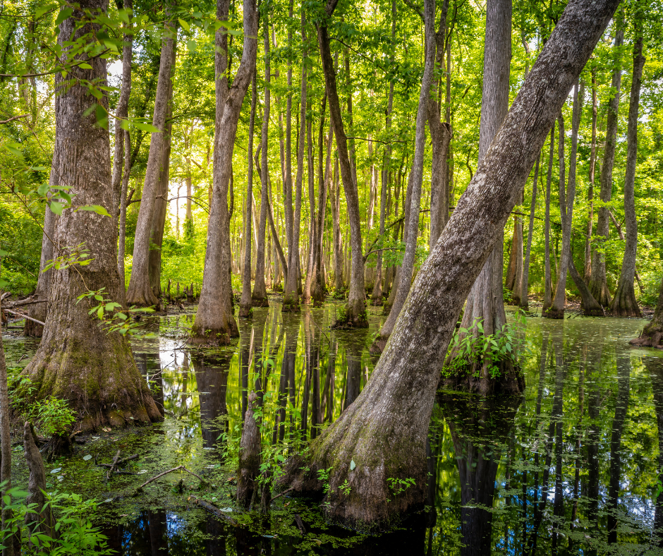
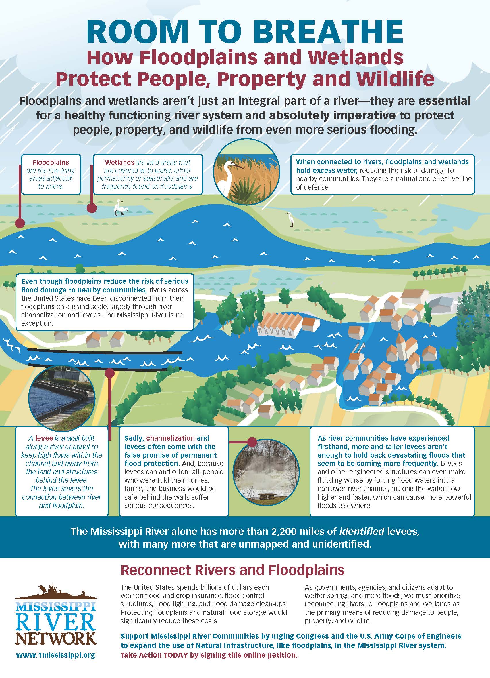
Wetlands protect our communities. They filter pollution, reduce flooding, provide wildlife habitat, and support the health of the Mississippi River system. But across the country, wetlands continue to be dredged and filled for development. Until recently, it was surprisingly difficult for the public to track where and how this was happening over time. And without that information, communities are left in the dark about long-term impacts to their water, wildlife, and flood protection.
A new Wetlands Impact Tracking tool, developed by our partners at the Environmental Policy Innovation Center and in collaboration with our Mississippi River Network member organization, Healthy Gulf, helps change that.
Understanding Clean Water Act Protections
The scope of federal wetland protections has been narrowed in recent years due to court decisions limiting which waters qualify as “Waters of the United States” (WOTUS). These rulings have reduced protections for many wetlands and intermittent streams.
Environmental advocates argue that waters are interconnected and that weakening protections for some wetlands ultimately harms downstream communities and ecosystems. Read more about recent WOTUS decisions here.
Under Section 404 of the Clean Water Act, anyone proposing to dredge or fill wetlands or other aquatic waters must obtain a permit. While the Clean Water Act is administered by the Environmental Protection Agency (EPA), Section 404 permits are issued by the U.S. Army Corps of Engineers (Corps), with EPA oversight and veto authority.
What is dredging and filling?
- Dredging removes sediment or soil from aquatic environments, which can damage sensitive habitats and uproot plants.
- Filling deposits soil or other materials into wetlands or waters, smothering vegetation and permanently altering the riverscape.
These permits are required because wetlands and streams are not empty spaces — they are living systems that support water quality, wildlife, and nearby communities.
The Challenge: Public Notices Disappear
When a Section 404 permit application is submitted, the Corps posts a public notice — typically for 30 days or more — giving communities the opportunity to review and comment. But once a final decision is issued, the permit often disappears from the Corps’ searchable database. Over time, this makes it extremely difficult to answer basic but important questions:
- How many wetlands have been impacted in a particular area?
- How many acres have been dredged or filled?
- Are impacts concentrated near certain communities?
- What does the cumulative impact look like over time?
Even though mitigation is required, mitigation is not the same as protection. Restored wetlands often do not function as well as undisturbed ones. Mitigation sites may be located miles away from the impacted community, and restoration projects can take years, if they succeed at all. Federal law requires projects to follow a clear sequence:
- Avoid impacts where possible
- Minimize impacts that cannot be avoided
- Mitigate remaining damage
That order matters. Because restored wetlands rarely replace the full ecological value of what was lost, avoiding impacts in the first place is the most effective way to protect wetlands and the communities that depend on them.
Enter the Wetland Impacts Tracking Tool
To make permit data more accessible, the Environmental Policy Innovation Center developed the Wetlands Impact Tracker. The tool systematically compiles and organizes data from Section 404 public notices posted by the Corps. As permit applications are released, the tool captures key information such as:
- Types of wetlands and aquatic resources impacted
- Acreage affected
- Project location
- Associated census tract
While the data is summarized, it provides enough information for community members, advocates, and researchers to track patterns over time. Armed with permit numbers, users can request full public records if a deeper review is needed.
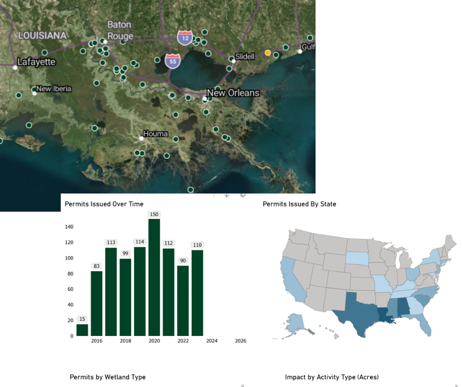
"The data goes back to 2012 as that's when the Corps began releasing permits digitally," said Gabriel Watson, Manager, Data Science and Applications, at the Environmental Policy Innovation Center (EPIC). "We used AI to determine the right industrial versus non-industrial grouping - industrial will generally be non-suburban and large project developments."
What the Data Reveals
The interactive maps show where development and wetland impacts are clustered, including along stretches of the Mississippi River commonly referred to as “Cancer Alley” in Louisiana. By linking permit data to census tract information, the tool also allows users to explore environmental justice implications. Analysis by the Environmental Policy Innovation Center found that disadvantaged communities are significantly more likely to:
- Live in areas zoned for industrial development, and
- Experience greater cumulative wetland and aquatic resource loss
These findings reinforce what many communities have long experienced: environmental burdens are not distributed equally.
How You Can Use the Tool
Wetlands protect communities across the Mississippi River basin — but we can only protect what we can see. The Wetlands Impact Tracker makes it easier to:
- Follow development patterns in your region
- Understand cumulative wetland impacts
- Identify projects near your community
- Prepare informed public comments
Whether you’re reviewing a project near your home or simply learning more about how wetlands are changing, this tool gives you the information you need to stay engaged.
Transparency leads to accountability. And accountability helps protect the Mississippi River and the communities who call it home.
Additional Resources
- Search current Corps public notices:
https://rrs.usace.army.mil/rrs/public-notices - Explore the tool:
https://www.policyinnovation.org/insights/wetlands-tracker - Questions about the tool? Contact: info@climateprogramportal.org

Blog by Olivia Dorothy
One Mississippi